

Quick answer
The bondhus glacier lake hike is a moderate 5-kilometer round-trip trail with 300 meters of elevation gain, taking most hikers 2 to 3 hours total. The path is well-marked and maintained, with rocky sections and wooden staircases in steeper stretches. Weather changes rapidly in the valley, and snow can linger on higher sections into early summer, so check conditions before setting out.
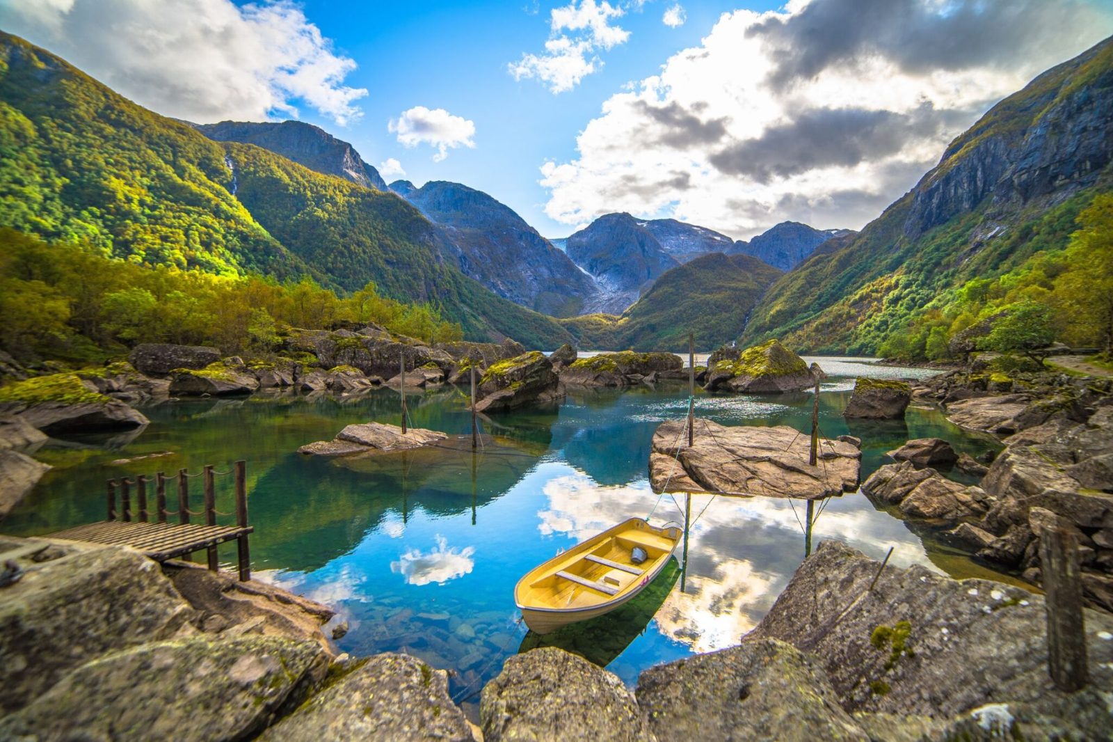
The trailhead sits at the far end of Bondhusdalen parking area, elevation 120 meters, where a signpost marks the route to Bondhusvatnet. The first kilometer climbs gently through birch and rowan, crossing a wooden footbridge over Bondhus River before the gradient steepens. Beyond the forest line, the trail enters open moraine terrain scattered with glacial erratics and low alpine scrub. The steepest section lies between kilometer 1.5 and 2, where the path gains roughly 200 meters over a series of switchbacks and timber staircases installed to prevent erosion. Footing here is a mix of compacted gravel, exposed bedrock, and loose stone. Trekking poles help on descent. The trail levels out as it approaches the lake basin, where meltwater streams carve channels through bare rock and the Folgefonna ice tongue becomes visible across the water. Bondhusvatnet itself spans roughly 1.2 kilometers, its water colored jade-green by glacial flour suspended in runoff. The official trail ends at the lake's southeastern shore, where a flat viewing area offers unobstructed sightlines to the glacier. A faint social trail continues along the eastern bank, but the terrain becomes unstable and is not maintained. Return via the same route. Fitness requirements are moderate. The trail is accessible to most hikers with basic conditioning, but the elevation gain and uneven surfaces demand attention. Children and older adults complete the bondhus glacier lake hike regularly, though the descent requires controlled footing. Weather in the Folgefonna region shifts without warning—clear mornings can turn to fog and rain by midday. Carry windproof layers, even in summer. Snow patches persist on north-facing slopes through June, and ice can form overnight in spring and autumn. The parking area at Bondhusdalen charges 125 NOK per vehicle per day, payable at the self-service kiosk near the entrance.
“The steepest 200-meter gain happens over a kilometer of switchbacks and timber stairs, where loose stone and exposed bedrock demand controlled footing.”
Step-by-Step Guide for the Bondhus Glacier Lake Hike
The Bondhus Glacier Lake hike is a well-maintained 3-kilometer trail (one way) that climbs 300 meters from the parking area to the lake's edge. Most hikers complete the round trip in 2.5 to 3 hours, depending on pace and photo stops.
Start at the Bondhusdalen parking area
The trailhead begins at the far end of the parking lot, marked by a wooden sign and information board. Many hikers miss the trail register box here—signing in helps search-and-rescue teams if needed.
Follow the red 'T' markers uphill
The path is marked with red painted 'T' symbols on rocks and trees throughout. The first 1.5 kilometers ascend through birch forest on wide, rocky steps—wear boots with ankle support, as loose stones shift underfoot.
Cross the wooden footbridge at the stream
At roughly the halfway point, a sturdy wooden bridge spans a glacial stream. The bridge can be slippery after rain; use the handrails and avoid stopping in the center where most people take photos.
Navigate the boulder field section
Beyond the bridge, the trail opens into a rocky moraine field with larger boulders. The red markers are painted on stones here—scan ahead for the next marker before committing to a route, as hikers often veer off onto dead-end boulder scrambles.
Reach the lake viewpoint platform
The trail terminates at a wooden viewing platform on the lake's southern shore, offering direct views of the glacier tongue and turquoise water. The platform has space for about 15 people; during peak hours, expect to wait a few minutes for a clear view.
Getting to the Bondhus Glacier Lake Hike
Bondhus Glacier Lake is located in the Bondhusdalen valley in Mauranger, accessible primarily by car from Bergen. The drive involves traveling south through the Hardanger region toward the Folgefonna National Park area.
E39 and Route 7 via Norheimsund and Tørvikbygd-Jondal ferry
E16 and Route 13 via Voss and Hardanger Bridge
Bondhusdalen access road from the designated parking area
Best Time and Arrival Strategy for the Bondhus Glacier Lake Hike
The optimal arrival window is between 07:00–18:00 to avoid mid-day crowds and ensure sufficient daylight for the hike. Planning your visit outside of peak holiday periods improves the experience on the trail.
June to August
High traffic, parking fills earlyTemperatures 10°C–18°C; long daylight hours
Expect the most visitors and full parking facilities during these summer months.
September to October
Moderate traffic, quieter trailsTemperatures 5°C–12°C; fading daylight
Crisp air and autumn colors provide clear views, though days grow significantly shorter.
Weekday mornings
Lowest crowds, peaceful environment—
Arriving before 09:00 provides the most solitude on the path to the lake.
Verdict: The best time to visit is on weekday mornings between June and September, aiming for an arrival at 07:00 to secure parking and complete the hike in daylight.
Opening Hours for the Bondhus Glacier Lake Hike
The Bondhusdalen valley is accessible to hikers throughout the week, offering round-the-clock access to the trail and glacier lake.
| Monday | 00:00–23:59 | |
|---|---|---|
| Tuesday | 00:00–23:59 | |
| Wednesday | 00:00–23:59 | |
| Thursday | 00:00–23:59 | |
| Friday | 00:00–23:59 | |
| Saturday | 00:00–23:59 | |
| Sunday | 00:00–23:59 |
Check availability
Frequently Asked Questions About Bondhus Glacier Lake Hike
Everything you need to know about bondhus glacier lake hike